Thank you for your response I think it is something I've done in Terra the more I think about it as never had a problem before with the drone and RTK flights
So I will try messing with settings also what I have tried is moving the GCP'S by the error difference and when I do this they match to within 15mm which is a work around currently as we have scan data to match it too but I want to sort it for the next project as it's knocked my trust in it.
Hope this makes sense
Are your control points check points or ground control points or a combination of both?
When you are taking away the "error" you are basically doing what I mentioned, although not in the correct way. I am unsure about the resolution of the geoid in your area, but in the US, NAVD88, geoid 18 will have a different undulation value for every single image processed so it is most likely that you will be similar.
When drones are receiving corrections they are expecting the elevations to be in an ellipsoid value.
When you collect control points you setup your GNSS rover to collect in the vertical system you choose. You could do orthometric or ellipsoidal.
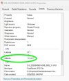
It looks like you collected your control points in orthometric. I would need to see the control points csv and some images to confirm.
When you are processing in Terra, it looks like you have the control points in orthometric elevation and the images in ellipsoidal, hence the shift.
Look at your control point csv and see if a column has ellipsoidal values and if so reprocess using those values.
Then in Terra output in your desired horizontal projection and choose to output in orthometric elevations using your preferred project vertical datum and geoid.
Agisoft Pro makes this whole process extremely easy. On a single screen you state your project's output datum/coordinate system, image datum/coordinate system and control points datum/coordinate system. And you can easily create combination system's of your own. Pix4Dmapper has its own mess, and Terra from what i remember was something also not easy in my opinion since you entered this on different screens.
All of this is speculation since I don't see the data. Hope this helps.