Welcome Matrice Pilots!
Join our free DJI Matrice community today!
Sign up

DJI Matrice 300 RTK won't display satellite view in the flight planning feature when connected to satellites.

Joined
Jun 4, 2025
Messages
2
Reaction score
0
Age
21
I've been working with my Matrice 300 RTK for a school project for a couple of days now, and I'm trying to use the flight planning feature to plot out my route. All the videos I've watched, showing me how to use it, have shown the controller having the statlite view of the area, making flight planning easier. Mine does not show the satellite view even when connected to 23 satellites in the area. I'm using the stock controller that comes with the Matrice 300 RTK. Any help would be greatly appreciated
 
By satellite view do you mean maps?
If so do you have an internet connection when in the area? They will download, but with a slow internet connection it could take some time.

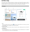
You can try and upload the maps. Pay attention to 1. Me - Go into this menu and download offline maps.
There are some Youtube videos showing this process, but you should be able to figure it out. You will need a strong internet connection.


1750013696864.png
 
Yes, that is what I mean. I need the local maps for the flight planning feature, as it's not displaying any of the. That might be exactly what I need. Thank you for your help. I'll try that and I'll update you on how it goes.
 

Members online

No members online now.

Forum statistics

Threads
2,898
Messages
26,033
Members
5,979
Latest member
jrussell