Welcome Matrice Pilots!
Join our free DJI Matrice community today!
Sign up

RTK mapping with Matrice 4T

Joined
Apr 14, 2025
Messages
2
Reaction score
2
Age
28
Hi everyone,

I'm new here in the forum and reaching out because I’d like to know if anyone has experience using the Matrice 4T for surveying with RTK-level accuracy.

Up to now, I’ve been using the Phantom 4 RTK for mapping, which worked flawlessly. Since I now also need thermal imagery for some of my projects, I decided to switch to the Matrice 4T to cover both RGB and thermal in one drone.

I just did my first test flight with the Matrice 4T using only the RGB camera. According to DJI and the reseller of the drone in my country, the RTK data should be stored in the EXIF metadata of the images. However, when I process the images with photogrammetry software, the resulting orthophotos don’t seem to reflect RTK-level accuracy. It looks like the software isn’t correctly reading the RTK info from the EXIF files.

Has anyone else encountered this issue or found a workaround?

Thanks in advance!
 
  • Like
Reactions: Steve A
The Matrice 4 T does NOT produce survey grade accuracy like the Matrice 4 E. The same thing is true with the Mavic 3E and Mavic 3T.

Also, the RGB camera on the Matrice 4T is not the same higher quality Micro 4/3 found on the Matrice 4 E with its mechanical shutter.

You will need to add Ground Control Points to get the accuracy you desire.
 
  • Like
Reactions: hydromapping
I have read about the Ground Control Points but one thing I am not clear on is do the markers for these Ground Control Points need to be in the sight path of the drone as it flys the path?
Yes. A control point is a marker that the drone's images must show.
You measure the center of the control point with a GNSS unit which could be a Trimble, Emlid or DRTK unit.
You now have low centimeter accurate data on the location of the center of the control point.
In photogrammetry software such as Terra, Agisoft or Pix 4D, the exact coordinates are now known of the center of the control point.
With a GCP or Ground Control Point, the software will shift the data if it is incorrect to line up with your control points since they are a known value.
With a Control Point used as a Check Point, the software will make a map/model and then "check" to see how close or far away the maps coordinates are compared to the known check points coordinates.

Control Points of both types need to be spread out over the mapped area. Think of them as being legs holding up a flimsy table top.

1744860964207.png

1744861009045.png


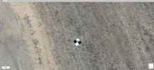
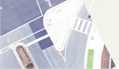
Here is a map where only 5 control points were used as GCPs. The drone did not have RTK. The GCPs shifted the map to the correct coordinates, hence why the coordinates are directly in the target.

1744861284952.png


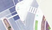
Here is the same map where the 5 control points were used as check points. The drone did not have RTK and no GCPs were used. Notice how the map is shifted.

1744861413444.png
 
  • Like
Reactions: Steve A
The Matrice 4 T does NOT produce survey grade accuracy like the Matrice 4 E. The same thing is true with the Mavic 3E and Mavic 3T.

Also, the RGB camera on the Matrice 4T is not the same higher quality Micro 4/3 found on the Matrice 4 E with its mechanical shutter.

You will need to add Ground Control Points to get the accuracy you desire.
thanks a lot for your quick response. What the reseller promised sounded a bit too good to be true anyway...
 
  • Like
Reactions: johnsmithyai
thanks a lot for your quick response. What the reseller promised sounded a bit too good to be true anyway...
If you still have the Phantom 4 RTK, use that for your visual map. Then process your thermal map.
Pick your own control points on the visual map that you can find in the thermal map.
Now you can have the thermal map overlay the visual map very well.

The Phantom 4 RTK's visual camera is better than the Matrice 4 T's. Don't let the 48 megapixel (Pixel binning) fool you. The Phantom has a larger 1" sensor with mechanical shutter. Also the Phantom's images will be smaller and these smaller images will process faster.

I kept my Phantom 4 RTK because it still makes great maps, is just as accurate as the Matrice 4E and Mavic 3E. It's camera is a notch below the Matrice 4E and mavic 3E, and it is much slower in taking and writing the images to the SD card, but it is still a great backup tool! It is also easier to keep line of sight, since in the US where I am, you must keep it in you line of sight.
 

Recent Posts

Members online

No members online now.

Forum statistics

Threads
2,855
Messages
25,869
Members
5,895
Latest member
Snaked