To review, Smart RTH doesn't look at percentages like the 2 battery warnings do. SRTH is just an algorithm that triggers RTH anytime it thinks that the drone needs to go home now based upon it's decision that it will hit critical battery level before it gets there. That's all fine. Except, it can get it wrong sometimes .
Copy that. All I can say is that I've never had a MapPilot mission interrupted because of battery percentage. I know this to be true because I have pushed at least 1/2 dozen missions past the 30% point before returning home. That said, before setting the timer to 24 minutes, I had many missions interrupted by the auto timer.
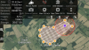
I think SRTH is on in both (all) versions.
Perhaps. I won't disagree.
**Off topic alert**
As someone else that is very particular about updating apps, what does v2.9.2 do for you that 4.1.8 does not, specifically?
With v2.9.2 the MapPilot developers got the camera control spot on. Then they screwed it up in subsequent versions. Let me explain.
When I set "Shutter priority" in ANY platform, I expect the Shutter and ISO to remain locked down to my chosen settings, and the aperture to adjust dynamically to compensate for different lighting conditions. v2.9.2 does this perfectly. For whatever reason, Map Pilot screwed it up in subsequent versions. I'll set the ISO to 200, but Map Pilot reports back an ISO of 100. In some versions "Shutter Priority" mode acts exactly like Auto mode, adjusting everything at will, and in a weird manner. I once did a shoot where I set ISO @ 200, Shutter @ 1/1600 in Shutter Priority mode. Almost immediately the ISO jumped to 800, the aperture slammed shut to like f/8, and the pictures were not only dark, but were grainy and had slight motion blur. WTF??? With version 2.9.2, the shutter and camera behave exactly as expected. They got v2.9.2 right, but then screwed it up. I have bitched to Zane about this to no avail.
Also curious what version of ios and devices you are running.
Thx!
As I'm sure you gathered, I HATE updating ANYTHING. My iPads are no different.
Air 1 = iOS 12.1.1 (16C50)
Air Pro, Gen 2 = iOS 12.1.4 (16D57)
Air Pro, Gen 3 (12.9' WiFi) = iOS 12.3.1
While I HAVE updated them, there are 3 things worth noting:
1) Updates are months behind the release date.
2) I always have an exit strategy (full backup in my PC - NOT iCloud - so I can roll back to the previous iOS if I wish).
3) All 3 iPads are in an almost perpetual state of asking permission to update.
Worth noting, the roll back isn't straight forward. Instead of creating an actual image of the iPad, the backup still has to go out to the Internet to get apps (legacy or otherwise) from the Apple servers. This is how I came to know that Apple archives ALL versions of ALL apps. They simply don't allow the public access to them. However, you CAN get them if you know the hack.
D