Welcome Matrice Pilots!
Join our free DJI Matrice community today!
Sign up

210 or 210RTK

Joined
May 24, 2022
Messages
13
Reaction score
7
Age
61
Hi everyone. I am about to buy an M210. The pricing is ridiculously good on these drones. I was about to pull the trigger on a used 210RTK and then I finally really understood that the system is for in flight guidance and does not write RTK coordinates to image files. I felt like if this is true, then I will still need to make decisions regarding geo correction procedures. It seems to me that, (at least when using a 210 drone) that GCP's will have to be implemented for accurate results.

If I am correct in my understanding, then maybe it just is not worth buying an RTK version drone and maybe buy a 210 V2 and spend the saved cash on a nice base station/rover setup. I am making this post to hopefully get some experience sharing from those of you who are using your drone commercially. Maybe asked something like this:

- Telecommunication inspections: RTK is not going to save you from this interfearance so do you think you need an RTK drone?
- Mapping of any type: If high precision is required, then you will need GCP's so do you feel that you need an RTK drone?
- Oil and Gas Inspections: Flying a Z30 and Thermal payload. If it requires location accuracy, then you need GCP's. Do you think you need an RTK drone?
- Solar installations: Flying a Z30 and Thermal payload. If it requires location accuracy, then you need GCP's. Do you think you need an RTK drone?

I do understand that the RTK is not dependant on the compass so the RTK setup will avoid interference problems.
 
I decided to buy an M210 v2. I am just not sold on the RTK that comes with the drone. At this point at least, I feel like there is better 3rd party options. Perhaps I am making a mistake, we shall see. I bought a minimally used drone privately.
 
  • Like
Reactions: Splocal
Hi @Libitron , you have launched a very interesting topic here and I'd love to know more, too. Sadly there is very little response.
I agree with you that the 210v2 RTK system that comes in the box is not the most versatile. I decided exactly the same as you have. Now I am looking for an aftermarket / 3rd party RTK solution. What are your thoughts after your experience the past weeks?
 
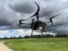
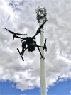
Well first I want to say that I have put the 210 through its paces. I have done some thermal mapping of industrial buildings, several ag missions with a MicaSense RedEdge MX, thermal and visual inspections of cell towers and I have even tried some cinematic shots. I never thought I would find a drone that I like to fly more than my trusty phantom 4 pro. Or to be as vicious as my inspire 1’s. The M210 Is impressive to say the least. From the ease of doing maintenance work like cleaning, inspecting, software And firmware maintenance, it also flies and handles like a dream. I’m usually less than 2000 feet from a home point when flying. I flew this drone out to 6000 feet. Only at that point did I lose one bar of connection. I’ve used the dual gimbal set up pretty much all of the time. When I’m flying something like a cell tower, I will start the video recording of my XT and then change view to the RGB camera that I’m using and take photographs. So I can get both cameras to work at one time in some scenarios. I enjoy close proximity flight and practice it a lot. With this drone and the Z30 or a 45 mm on my X5S, I don’t even have to fly very close. The only time I’ve ever gotten to 30 feet from a tower with this drone Is when I was doing a 3-D model with the X4S. The one and only gripe I have is the resolution of the Z30. There is no zooming in on those photographs so you have to get it right when you pull the trigger. I even like the OEM case just fine.
Support from all of the software that I am interested in using for my work is very good. I did ask a few questions on this and one other forum about applications and configurations. For example I wasn’t quite sure what way to go with my agriculture mapping. A couple guys suggested using DroneDeploy for the mission and the camera set up in the mission being the X4S. They were exactly correct. I’m getting great overlap and my customers are very happy with my deliverables.
Maybe you were asking me about the RTK versus no RTK. To be very honest, sometimes when I’m flying around power installations, I wish I did have an RTK drone. That is the only time. I have talked to third-party companies about an RTK solution which will be useful to the degree that it actually will provide corrections to the media files. There is some help out there but nothing that I would choose over base station and rover. One company is modifying the X4S. It’s a good idea but not for my needs so far. And the reason is that many times I will be in Flight without the X4S camera mounted. For example inspections… That is an XT and Z30 payload or X5S with another lens like a 45 mm or a 14-42 zoom. The 25 mm on the X5S is also awesome for some inspection applications.

I like the drone, even without the RTK. If I were buying one today, I would buy the RTK version however. Only because I believe it may be safer. On a few occasions, I was a little nervous and wished I had the added level of safety of the RTK. I would likely use the RTK one in 10 flights, but that’s enough.

F0F5C310-FE71-49FF-9011-9CE2FA62C4EE.jpeg

293285B0-FFB3-41AF-B44C-AE87D9D3936D.jpeg
 
  • Like
Reactions: Splocal
Thanks @Libitron for such an elaborate and informative answer! I much appreciate it. I would like the RTK system aboard the aircraft to tag the accurate location data to every photograph but the M210V2RTK does not do that.

I suppose with a base station / rover setup you mean adding ground control points, recording their exact coordinates and processing that along with the image set in Pix4D or DroneDeploy. It will, I think, deliver a more accurate deliverable. But it's not cheap. Look at this though, Reach RS+ – buy RTK GNSS/GPS receiver at best price | Emlid Store. They're really good and more affordable than many others. You'll need two of these (one acts as base station and the other you use to nail down your GCPs).

Good luck!
 
Well first I want to say that I have put the 210 through its paces. I have done some thermal mapping of industrial buildings, several ag missions with a MicaSense RedEdge MX, thermal and visual inspections of cell towers and I have even tried some cinematic shots. I never thought I would find a drone that I like to fly more than my trusty phantom 4 pro. Or to be as vicious as my inspire 1’s. The M210 Is impressive to say the least. From the ease of doing maintenance work like cleaning, inspecting, software And firmware maintenance, it also flies and handles like a dream. I’m usually less than 2000 feet from a home point when flying. I flew this drone out to 6000 feet. Only at that point did I lose one bar of connection. I’ve used the dual gimbal set up pretty much all of the time. When I’m flying something like a cell tower, I will start the video recording of my XT and then change view to the RGB camera that I’m using and take photographs. So I can get both cameras to work at one time in some scenarios. I enjoy close proximity flight and practice it a lot. With this drone and the Z30 or a 45 mm on my X5S, I don’t even have to fly very close. The only time I’ve ever gotten to 30 feet from a tower with this drone Is when I was doing a 3-D model with the X4S. The one and only gripe I have is the resolution of the Z30. There is no zooming in on those photographs so you have to get it right when you pull the trigger. I even like the OEM case just fine.
Support from all of the software that I am interested in using for my work is very good. I did ask a few questions on this and one other forum about applications and configurations. For example I wasn’t quite sure what way to go with my agriculture mapping. A couple guys suggested using DroneDeploy for the mission and the camera set up in the mission being the X4S. They were exactly correct. I’m getting great overlap and my customers are very happy with my deliverables.
Maybe you were asking me about the RTK versus no RTK. To be very honest, sometimes when I’m flying around power installations, I wish I did have an RTK drone. That is the only time. I have talked to third-party companies about an RTK solution which will be useful to the degree that it actually will provide corrections to the media files. There is some help out there but nothing that I would choose over base station and rover. One company is modifying the X4S. It’s a good idea but not for my needs so far. And the reason is that many times I will be in Flight without the X4S camera mounted. For example inspections… That is an XT and Z30 payload or X5S with another lens like a 45 mm or a 14-42 zoom. The 25 mm on the X5S is also awesome for some inspection applications.

I like the drone, even without the RTK. If I were buying one today, I would buy the RTK version however. Only because I believe it may be safer. On a few occasions, I was a little nervous and wished I had the added level of safety of the RTK. I would likely use the RTK one in 10 flights, but that’s enough.

View attachment 30537

View attachment 30538
Great write up thanks! I just purchased an M210 V1 with a Z30 and XT2! Really looking forward to using it and super happy to read that the 3rd party RTK solutions for survey mapping are a better choice than the OEM RTK setup on the M210 RTK. Please fill me in though, I thought you could just buy the RTK module and add it to the M210? Is that not the case? I am confused by the 3rd party ground station RTK and built in RTK systems and how they differ? I want to have safe control of the drone while doing bridge inspections or powerline inspections, I thought this was something I could just add later if needed.
 
Thanks, that’s a nice complement. I just want to be sure that you shouldn’t be considering me an expert. I’m just saying what my experience is. I’m comfortable and confident in my knowledge but what’s been discussed in this thread should involve a lot of personal reading. I also know that the information online is miserably vague and difficult to sort through


I thought you could just buy the RTK module and add it to the M210?
I’m quite certain the answer is no, if you were talking about adding on the DJI components.


I am confused by the 3rd party ground station RTK and built in RTK systems and how they differ?
The built in RTK system is just a drone control system. Nothing more. A third party base station is used to acquire positioning. It would be used as a known location, then a rover could be used to mark GCP’s by determining its position relative to the known location. If I’ve made an error here in someway, some people will catch it quick. The only thing I’m not sure if the word relative is correct, but thats how I would describe it since the rover gets it’s position from the base station.

I want to have safe control of the drone while doing bridge inspections or powerline inspections, I thought this was something I could just add later if needed.
The system that I had my eye on was the Emlid RTK. Seems like a perfect upgrade to me. If I understood it correctly, it provided the RTK for both Drone control and the ability to write the Geo location information directly to the files. It seems to have disappeared recently from their site. They have other systems that they suggest be used with drones however require a hot shoe to trigger the writing of data. I am not too concerned because I am going to buy a 210RTK. I will keep the 210v2 as well. It is so bada**.

For mapping I still think GCP’s are the way to go.
 
Last edited:
  • Like
Reactions: MikeA and Splocal
Thanks for the quick response and detailed write up. I was actually looking at the Emlid M2 setup today. I’m pretty sure it mentioned increased drone gps accuracy which made me think it could help with flying around areas with GPS interference. Sounds like you have still had pretty good success with the M210 V.1 and it is still a very viable option for me to start off with. Thanks for helping a noob understand this a little better!
 
Great write up thanks! I just purchased an M210 V1 with a Z30 and XT2! Really looking forward to using it and super happy to read that the 3rd party RTK solutions for survey mapping are a better choice than the OEM RTK setup on the M210 RTK. Please fill me in though, I thought you could just buy the RTK module and add it to the M210? Is that not the case? I am confused by the 3rd party ground station RTK and built in RTK systems and how they differ? I want to have safe control of the drone while doing bridge inspections or powerline inspections, I thought this was something I could just add later if needed.
Let the community know how the M210 meets your inspection missions. Thank you.
 
I certainly will thank you Tom! I am also looking Into a LiDAR setup for surveying and 3D modeling of inspections, more to come!
 
Hi everyone. I am about to buy an M210. The pricing is ridiculously good on these drones. I was about to pull the trigger on a used 210RTK and then I finally really understood that the system is for in flight guidance and does not write RTK coordinates to image files. I felt like if this is true, then I will still need to make decisions regarding geo correction procedures. It seems to me that, (at least when using a 210 drone) that GCP's will have to be implemented for accurate results.

If I am correct in my understanding, then maybe it just is not worth buying an RTK version drone and maybe buy a 210 V2 and spend the saved cash on a nice base station/rover setup. I am making this post to hopefully get some experience sharing from those of you who are using your drone commercially. Maybe asked something like this:

- Telecommunication inspections: RTK is not going to save you from this interfearance so do you think you need an RTK drone?
- Mapping of any type: If high precision is required, then you will need GCP's so do you feel that you need an RTK drone?
- Oil and Gas Inspections: Flying a Z30 and Thermal payload. If it requires location accuracy, then you need GCP's. Do you think you need an RTK drone?
- Solar installations: Flying a Z30 and Thermal payload. If it requires location accuracy, then you need GCP's. Do you think you need an RTK drone?

I do understand that the RTK is not dependant on the compass so the RTK setup will avoid interference problems.

The M210 RTK is a high-precision drone that utilizes Real-Time Kinematic (RTK) technology to provide accurate positioning and navigation data. However, it is important to note that while RTK can improve the accuracy of your drone's positioning and navigation, it does not automatically write RTK coordinates to image files. This means that you will still need to implement geo-correction procedures in order to ensure that your images are correctly geolocated.

Whether or not you need an RTK drone will depend on the specific use case and the level of precision required. Here is a breakdown of your questions:

  • Telecommunication inspections: RTK technology can be useful in this scenario as it can help to ensure that your drone is able to navigate accurately in a complex environment with multiple radio frequency sources. However, it may not be necessary if your main focus is on capturing images and video rather than precise navigation.
  • Mapping of any type: If high precision is required, then you will likely need to implement GCPs (Ground Control Points) in addition to using an RTK drone. GCPs are physical markers placed on the ground that are used to accurately geolocate images and create high-precision maps.
  • Oil and Gas Inspections: If your inspections require accurate location information, then you may need to use GCPs in addition to an RTK drone. In this case, the RTK technology will help to ensure that your drone is able to navigate accurately in a complex environment and the GCPs will be used to accurately geolocate the images.
  • Solar installations: Similarly, if your solar inspections require accurate location information, then you may need to use GCPs in addition to an RTK drone. In this case, the RTK technology will help to ensure that your drone is able to navigate accurately in a complex environment and the GCPs will be used to accurately geolocate the images.
 
I think that main purpose and objective of this thread became making sure that people did not have unrealistic or misunderstood expectations of the M210 RTK. Additionally, the group has discussed experiences using the drone.

Our company invested in Emlid GNSS equipment. We also invested time and money in training of the use. We have bought dual channel equipment and could not be more happy. We have both 210 V2 and 210 V2 RTK Drones. The RTK Drones primarily get used when we are operating in areas with higher electromagnetic interference.

Here it is January 2023. We still feel like the 210 can carry payloads that deliver excellent results and so ROI on this equipment is fantastic. We are in no hurry to retire them at all.
 
  • Like
Reactions: ozzey1

Members online

No members online now.

Forum statistics

Threads
2,726
Messages
25,386
Members
5,599
Latest member
ctfulgham