

You are using an out of date browser. It may not display this or other websites correctly.
You should upgrade or use an alternative browser.
You should upgrade or use an alternative browser.
M30T for thermal solar farm inspection
- Thread starter Juan Diaz
- Start date

- Joined
- Mar 22, 2017
- Messages
- 59
- Reaction score
- 19
- Age
- 60
Yes it is similar to most other thermal payloads out there. It looks like the focal length is 9.1mm so it will give you a wider FOV, which equates to less pixels on target. Not really a factor for Solar, but for roof inspection. If you want to do post processing of images with Flir Tools, you will need to use a third party app to covert the images to a format supported by Flir. I don't see it identified as Radiometric, but also not really needed for solar inspection. CommercialDronePilots has someone that recently posted that has one and is sharing information on it. Also, there are several good vendors on these forums that can probably provide some field testing that might help.I´ve been trying to confirm if the M30T is able to work thermal inspections over solar panel farms.
I heard that there is a software limitation in the temperature range detection on the M30T camera that makes it no good for it.
Any comments would help.
- High Gain Mode: -20° to 150° C (-4° to 302° F)
Low Gain Mode: 0° to 500° C (32° to 932° F)
Yes it is similar to most other thermal payloads out there. It looks like the focal length is 9.1mm so it will give you a wider FOV, which equates to less pixels on target. Not really a factor for Solar, but for roof inspection. If you want to do post processing of images with Flir Tools, you will need to use a third party app to covert the images to a format supported by Flir. I don't see it identified as Radiometric, but also not really needed for solar inspection. CommercialDronePilots has someone that recently posted that has one and is sharing information on it. Also, there are several good vendors on these forums that can probably provide some field testing that might help.
- High Gain Mode: -20° to 150° C (-4° to 302° F)
Low Gain Mode: 0° to 500° C (32° to 932° F)
The M30's thermal sensor is radiometric. I just happened to play around with one at an exposition today.
- Joined
- Jun 28, 2022
- Messages
- 15
- Reaction score
- 10
- Age
- 63
I don't see any absolute showstoppers for "general" use of a M30T for solar farm inspections, but there are definitely limitations and trade-offs you need to consider. I highlight those and do some calculations using the specs of the M30T to give you more insight. Beyond the M30T technical specs, you need to think about your entire workflow associated with capturing, analyzing, and reporting findings. There are a lot of moving parts to contend with!I´ve been trying to confirm if the M30T is able to work thermal inspections over solar panel farms.
I heard that there is a software limitation in the temperature range detection on the M30T camera that makes it no good for it.
Any comments would help.
jkerrins brings out a couple of important points that I will add to and maybe look at a little differently...
The 9.1mm lens on the M30T thermal camera provides a wide angle view (61° ) good for looking at large space quickly, but at the expense of spatial detail (aka "ground sampling distance"(GSD). There is a trade-off in all optical devices between the size of the Field of View and the level of spatial detail.
My answer to your question about the M30T viability for solar farm inspection will be impacted by how you answer this: For your inspection purposes, what levels of spatial detail (and Field of View) do you need to detect the various anomalies you are looking for? There are large size anomalies such as an offline string or panel and there are smaller anomalies such as cell level problems, reverse polarity, and cracking that require much more spatial detail (and maybe more engineering knowledge) to make judgement.
The image below is a screenshot I captured from a DJI promotional video for the M30T. I don't know the actual dimensions of the solar panels shown, but let's assume that they are about 1 meter (39") wide each. That would mean that the width of the Field of View of the solar panels in the foreground of image below is on the order of 100 ft. Since we have a thermal sensor with width of 640 pixels, we are getting a spatial resolution of about 6.4 pixels per foot which equals 1.875 inches per pixel (GSD) for the foreground (and about 20% worse for the rows of panels further back). With that level of spatial resolution, you can begin to detect thermal anomalies that are larger that 2"x2". Smaller sized anomalies that exist will be missed because the detail is missing.
Using the same assumptions as above, I did some additional math to estimate the altitude the drone was flying over the panels to be under 85 feet. The image appears to have the thermal camera gimbal tilted to be similar to the tilt of the solar panels--a best practice for this kind of work. The consequence of that is that the camera is about 85 ft to the front row of panels, but because of the tilt of the panels and orthogonal orientation of the camera, the altitude of the drone is lessened by a factor of the cosine of that tilt angle. Therefore, if the solar panel tilt angle was 30°, the altitude of the drone is 85ft * cos(30°)= about 74 ft. If you wanted spatial detail to be 1"x1" (GSD), you'd have to fly the mission at half that altitude = 37 ft. These are pretty low altitudes for flight--and within a range where trees and other man-made obstructions could be factors for conducting safe flights.

In my opinion, the wide angle lens of the M30T is oriented towards detection of larger anomalies and great for getting "big picture" data from a solar farm. Of course, if you need more spatial detail (smaller GSD) to identify smaller featured problems, you can lower the altitude--but at the expenses of reducing the size of the Field of View, increasing image count, elongating mission time, and last but not least...maybe needing to be concerned with navigating obstructions (like trees!) and maintaining visual line of sight with the drone throughout the entire flight.
If you move forward, I'll be interested to learn more from your experience.
Mike
Last edited:
Mike, great analysis. Thanks.
If I understood you correctly, at the end the limitation for the M30T camera is because of its 9.1mm lens (as the M2EA) ? If the lens had a focal length of 13.5 mm (as the H20T) then it would work properly within a secure altitude for standard and comprehensive inspections. But then, if the M30T is similar to the M2EA, why is it so popular and used for solar panel inspections?
Couple of weeks ago I spoke with Raptor Maps who told me they are working to support M30T solar panels thermal processing and hope to launch it in 1-2 months.
Having said that, if I take the risk to fly the M30T low (12-18 mts) it would be able to obtain good detail pictures for thermal inspection over solar panels.
I´m still to order the M30T planning to do power line and towers, cel antennas and (with caution) solar farm inspections.
Last edited:
- Joined
- Jun 28, 2022
- Messages
- 15
- Reaction score
- 10
- Age
- 63
Hello Juan,Mike, great analysis. Thanks.
If I understood you correctly, at the end the limitation for the M30T camera is because of its 9.1mm lens (as the M2EA) ? If the lens had a focal length of 13.5 mm (as the H20T) then it would work properly within a secure altitude for standard and comprehensive inspections. But then, if the M30T is similar to the M2EA, why is it so popular and used for solar panel inspections?
Couple of weeks ago I spoke with Raptor Maps who told me they are working to support M30T solar panels thermal processing and hope to launch it in 1-2 months.
Having said that, if I take the risk to fly the M30T low (12-18 mts) it would be able to obtain good detail pictures for thermal inspection over solar panels.
I´m still to order the M30T planning to do power line and towers, cel antennas and (with caution) solar farm inspections.
It's good that you're talking to Raptor Maps about support of the drone because you need to validate compatibility of every element involved in the workflow you are planning to execute. I think you mostly got my points and I believe that the M30T could be very capable of capturing images you need.
That said, you need to be careful comparing different cameras and lenses based on focal length alone. That's because it's a combination of specs that determine the size of the smallest detail that can be detected (aka Instantaneous Field of View) and the size of the image scene (Field of View). In addition to lens focal length, the sensor resolution and sensor size determine the IFOV and FOV.
Regarding your question about the popularity of M2EA for solar inspections: I think the selection of the M2EA (and the M30T for that matter) over any of the drones that have more payload flexibility like the M300/H20T, M300/XT2, or M210/XT2 comes down to a combination of trade-offs in acquisition cost, portability, and the fact that some buyers don't have application requirements where payload flexibility and configurability is needed. For example, not everyone needs to inspect the underside of a bridge where you'd need to mount a camera or thermal imager facing upwards to view the underside. You can't do that with a M2EA or M30T, but you could with the optional upward facing gimbal mount on a M210 or M300.
Again thinking about the overall workflow you will be engaged... Have you completed a Level I infrared thermography certification class to prepare yourself? If not, Fox River Systems offers one that is focused on thermal drone applications and operation that could enhance your qualifications. See the linked brochure for more information: Level I Infrared Thermography Applications with Operational Readiness Training for Thermal Drones
Mike
630-365-4030
Mike, learning a lot from your posts. Thanks!
I haven´t done any kind of infrared thermography certification but I will have to.
I read the content of Fox River Systems Level I training and feel it´s very complete. Minor problem, I live in Colombia, South America so it´s going to be tough...(Lol).
Would be good to have a chance to learn remotely...
Regards
Juan
This thread made me go and look at the specifications for the new M30T's thermal sensor, and yes, it seems like this sensor is going to be better for Public Safety applications than it will be for solar panel inspections.
I still like the Matrice 200 and 210 with different options for your thermal sensor, so that you can choose the best option for your use case.
There are a lot of great options now to choose from (Autel's Dual, Dual R and 640T, Mavic 2 EA, M300 RTK H20T and now M30T), but in my opinion there is no knockout combination. Each has pros and cons and if you want the radiometric FLIR sensor on the Autel, you are gonna pay. A Matrice 200/210 with XT2 is still in my opinion the most versatile solution, but its size and cost when new is still a bit of a problem. I have been pricing a DJI refurbished 210RTK and the now reduced cost XT2 13mm/640/30 or similar XT full radiometric and the pricing is similar to the M30T and in my opinion the XT2 13mm is a no brainer for solar applications with a proven track record.
I wish the M30T had swappable payloads and different options but that might make it too much of a direct competitor with the M300RTK.
Thanks for the great information Fox River Systems.
Mike, hello!
Found a web page to calculate the GSD starting with several known variables specifically for the M30T:
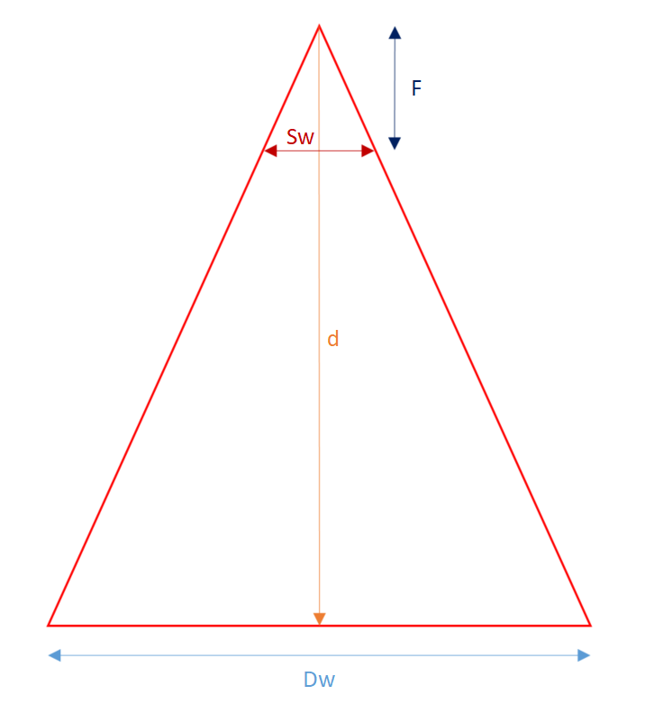
 www.3dflow.net
After trying different AGLs or Distance (d) in meters (trial & error) to obtain a GSD of 2.5cm (1 inch), the final number is 19.5mts or 64 ft. (Mike, very near from your initial calculations)

Regards,
Juan
Found a web page to calculate the GSD starting with several known variables specifically for the M30T:
Ground sampling distance calculator - 3Dflow
Ground sampling distance calculator Ground sample distance can be calculated with the following tool. Simply fill in the form below and the result will be updated in real time. Image width (pixels): Image height (pixels): Focal lenght (mm): Sensor width … Read More
After trying different AGLs or Distance (d) in meters (trial & error) to obtain a GSD of 2.5cm (1 inch), the final number is 19.5mts or 64 ft. (Mike, very near from your initial calculations)
Regards,
Juan

All that is doable but.. Is is possible to change the lens ?
I'm looking into changing the lens on M30T to get a hmm safer altitude.
I'm looking into changing the lens on M30T to get a hmm safer altitude.
- Joined
- Jun 28, 2022
- Messages
- 15
- Reaction score
- 10
- Age
- 63
No. The M30T lens is fixed and the camera and lens are not interchangeable. Fixed lens/focal length. If you prefer a drone that has possibility of switching between different focal lengths (to achieve variation on spatial resolution and Field of View), you could consider the M300 drone with Zenmuse XT2 cameras (plural). Or the older and proven M210 drone with XT or XT2 thermal cameras. Used M200/M210 are increasingly available for sale on eBay as products like the M30T and Mavic 2 Enterprise Advanced (and Mavic 3 ?) come to market with lower prices for their "fixed" configurations.All that is doable but.. Is is possible to change the lens ?
I'm looking into changing the lens on M30T to get a hmm safer altitude.
I have a M210 RTK with Zenmuse XT (640x512) with 19mm focal length that's great for when I want more pixels on my target and am willing to live for smaller Field of View and longer flight/acquisition times. And I have a Zenmuse XT2 (640x512) with 13mm focal length that's good for situations where I don't need as much detail and prefer the the larger Field of View and faster flight/acquisition.
Mike Gilley
- Joined
- Nov 9, 2022
- Messages
- 1
- Reaction score
- 1
- Age
- 67
Hi Mike,I don't see any absolute showstoppers for "general" use of a M30T for solar farm inspections, but there are definitely limitations and trade-offs you need to consider. I highlight those and do some calculations using the specs of the M30T to give you more insight. Beyond the M30T technical specs, you need to think about your entire workflow associated with capturing, analyzing, and reporting findings. There are a lot of moving parts to contend with!
jkerrins brings out a couple of important points that I will add to and maybe look at a little differently...
The 9.1mm lens on the M30T thermal camera provides a wide angle view (61° ) good for looking at large space quickly, but at the expense of spatial detail (aka "ground sampling distance"(GSD). There is a trade-off in all optical devices between the size of the Field of View and the level of spatial detail.
My answer to your question about the M30T viability for solar farm inspection will be impacted by how you answer this: For your inspection purposes, what levels of spatial detail (and Field of View) do you need to detect the various anomalies you are looking for? There are large size anomalies such as an offline string or panel and there are smaller anomalies such as cell level problems, reverse polarity, and cracking that require much more spatial detail (and maybe more engineering knowledge) to make judgement.
The image below is a screenshot I captured from a DJI promotional video for the M30T. I don't know the actual dimensions of the solar panels shown, but let's assume that they are about 1 meter (39") wide each. That would mean that the width of the Field of View of the solar panels in the foreground of image below is on the order of 100 ft. Since we have a thermal sensor with width of 640 pixels, we are getting a spatial resolution of about 6.4 pixels per foot which equals 1.875 inches per pixel (GSD) for the foreground (and about 20% worse for the rows of panels further back). With that level of spatial resolution, you can begin to detect thermal anomalies that are larger that 2"x2". Smaller sized anomalies that exist will be missed because the detail is missing.
Using the same assumptions as above, I did some additional math to estimate the altitude the drone was flying over the panels to be under 85 feet. The image appears to have the thermal camera gimbal tilted to be similar to the tilt of the solar panels--a best practice for this kind of work. The consequence of that is that the camera is about 85 ft to the front row of panels, but because of the tilt of the panels and orthogonal orientation of the camera, the altitude of the drone is lessened by a factor of the cosine of that tilt angle. Therefore, if the solar panel tilt angle was 30°, the altitude of the drone is 85ft * cos(30°)= about 74 ft. If you wanted spatial detail to be 1"x1" (GSD), you'd have to fly the mission at half that altitude = 37 ft. These are pretty low altitudes for flight--and within a range where trees and other man-made obstructions could be factors for conducting safe flights.
View attachment 30534
In my opinion, the wide angle lens of the M30T is oriented towards detection of larger anomalies and great for getting "big picture" data from a solar farm. Of course, if you need more spatial detail (smaller GSD) to identify smaller featured problems, you can lower the altitude--but at the expenses of reducing the size of the Field of View, increasing image count, elongating mission time, and last but not least...maybe needing to be concerned with navigating obstructions (like trees!) and maintaining visual line of sight with the drone throughout the entire flight.
If you move forward, I'll be interested to learn more from your experience.
Mike
Reading your interesting post, gave me the curiosity to dig dipper. I looked on the training program , and i'm asking you, if i can join this class from distance, couse i live in France.
Similar threads
- Replies
- 1
- Views
- 8K
- Replies
- 14
- Views
- 10K
- Replies
- 6
- Views
- 4K
- Replies
- 1
- Views
- 8K
- Replies
- 1
- Views
- 3K
