jaja6009's latest activity
-
JI use this Tenba re-configurable one - works great.
-
Jjaja6009 reacted to honkihonk's post in the thread Smart 3D Capture Route from photos in album with
 Like.
For anyone still interested: A local DJI vendor tested this. Local mapping is only available when the drone is connected. It doesn't...
 -
Jjaja6009 replied to the thread RTK issue warning.By RTK error, do you mean when you went into the RTK settings you had a Network error? While I had this problem last year upon release...
-
Jjaja6009 replied to the thread JZ AF1 BOTTOM MOUNTED Emergency Light.I have seen some lights, but the DJI light and speaker work so well I personally would not consider them. Some interesting DJI...
-
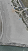
Jjaja6009 replied to the thread Downward facing panoramic?.I attempted a larger one. This one was a nadir dataset of our beach area. This one has a couple of stitching areas that I most likely...
-
Jjaja6009 replied to the thread Electricity Transmission Towers- Slope or Geometric Route?.No problem. I am not saying it will not work. You may tweak some things and have a better output. I did run it in Mipmap for gaussian...
-
Jjaja6009 replied to the thread Downward facing panoramic?.Your question intrigued me so I ran some more tests. When I uploaded all of the mapping images Panvolo failed. I thought about it and...
-
Jjaja6009 replied to the thread FAA OOP Operations Requirements.Most people do not follow the regulations outright. They will have portions of the flight most likely travel over people/moving...
-
JThanks for replying. By real world I only mean feedback from those who have or are performing drone property mapping services over...
-
Jjaja6009 replied to the thread FAA OOP Operations Requirements.There are two mainstream ways ways to legally fly over people. Have a Category drone (1-4) or get a waiver. There are some other ways...
-
Jjaja6009 replied to the thread Matrice 4 Series (E and T) are now compliant for Operations Over People Category 2 when equipped with an AVSS Parachute Recovery System!.The Manti does not have a DOC for the USA so it does not make the drone a Category drone. If it does have ASTM 3322-18+ it could...
-
JIt seems this comes down to if you are connected to Cloud Services, it waants to label your pins. And draws from FlightHub. Your Pilot...
-
Jjaja6009 replied to the thread Default handle for annotions.I have never thought of this. I do know that annotations can be labeled differently in Flight Hub 2. When having an internet...
-
Jjaja6009 replied to the thread Downward facing panoramic?.I thought this was such a unique idea I tried it in Panovola. It would not process. Maybe one of the pano software's mentioned above...
-
JGreat info, appreciated!


